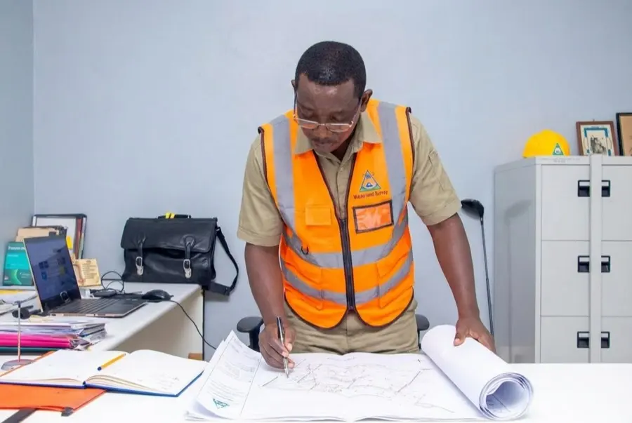
Walterland surveyor operating a total station above the Kenya coast
03°13′S · 40°07′E — Malindi, Kilifi County

We mark the line
before you
build on it.

Licensed ISK land surveyors with 30 years on the Kenyan coast. Cadastral, topographic, drone & GIS work delivered with the precision, compliance and proof you can register, finance and trust.

Get a Survey Quote View Our Services
1994
Established · Malindi
ISK
Registered surveyors
7
Survey service lines
3
Offices across Kenya

Thirty years,
measured.

A track record you can verify with registries, lenders and county agencies.

30+
Years of continuous practice on the coast
200+
Plots subdivided in a single coastal development
40 ha
Drone-mapped per day at centimetre accuracy
9+
KeRRA & county government projects delivered
// What we survey

Seven service lines,
one accountable team.

Not sure which? Talk to us →
01 Cadastral Surveys Title deeds, beacons, subdivision 02 Topographic Surveys Terrain analysis & site planning 03 Drone & Aerial Surveys Photogrammetry at 40+ ha/day 04 GIS & Spatial Data Enterprise systems for counties 05 Boundary Verification Due diligence & fraud prevention 06 Engineering Surveys Infrastructure & construction 07 Hydrographic Surveys Water & coastal mapping
Walterland survey service preview
01 / 07
Cadastral Surveys

Official boundary surveys that give your land legal standing — measured, beaconed and registered through Ardhisasa.

  • Title deed surveys & verification
  • Boundary demarcation & beaconing
  • Land subdivision & mutation
  • Ardhisasa-compliant digital submission
Walter Okoth, principal licensed surveyor, reviewing survey plans
PRINCIPAL SURVEYOR
Walter Okoth, ISK
// The practice

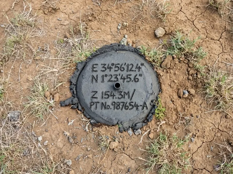
Protect your land investment with surveyors who sign their name to it.

From a Malindi surveying practice into a Kenyan land, GIS and infrastructure partner. The work stays practical: verify the parcel, mark the boundary, prepare the plan, and hand over documents clients can use with registries, lenders, contractors and public agencies.

ISK REGISTERED KCAA LICENSED 30 YEARS ON THE COAST
// Precision technology

Centimetre accuracy on every project.

CORS-enabled RTK GNSS, precision total stations, and DJI RTK drones, paired with enterprise GIS and three decades of judgement in the field. Cutting-edge tools, government-grade results.

Survey equipment, GNSS receiver, total station and drone prepared for fieldwork
01

Licensed & accountable

ISK-registered surveyors and KCAA-licensed UAV pilots on every assignment.

02

Modern instrument fleet

DJI RTK drones, CORS GNSS, precision total stations, enterprise GIS.

03

Government trusted

High first-submission approval rates with county and national agencies.

Cadastral · Topographic · Drone & Aerial · GIS & Spatial · Boundary Verification · Engineering · Hydrographic · Cadastral · Topographic · Drone & Aerial · GIS & Spatial · Boundary Verification · Engineering · Hydrographic ·
// Ready when you are

Survey the land before you commit to it.

Free quotes, no obligation. We respond to every enquiry within 24 hours, with replies on phone and WhatsApp.

Get your free quote Message on WhatsApp
Mon–Fri 8am–5pm · Replies within 24 hours